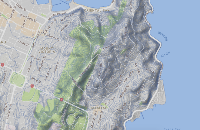
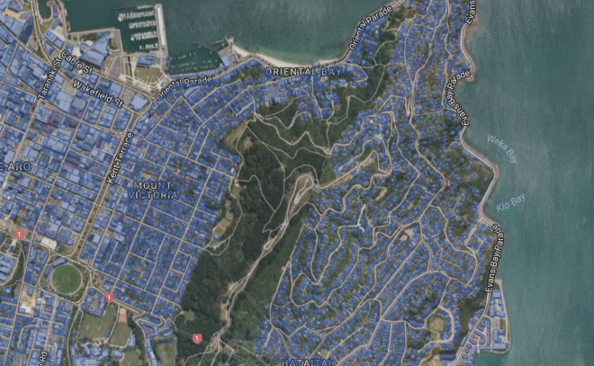
Site – Mt Victoria and surrounding area, most notably hillside and park areas around the summit.
Original Maori name Tangi Te Keo, also known as Matairangi by local iwi.
Mt Victoria not an official Title, but one that stuck.
Derives from a legend in which two taniwha tried to escape from Wellington Harbour which was then an enclosed lake. One taniwha became stranded and died, and its spirit turned into a bird named Te Keo, which flew to the top of the mountain and mourned (tangi). The second name translates as “to examine the sky”.
Wellington Town belt (park and grassed area) granted to the city in 1873 for public recreation. Vegetation mostly imported Pine and macrocarpa, planted 1800-1900.
Strong connection to Greek community through the events of the war. Up to 65% of Greek New Zealanders through to live in Wellington, and in decades following WW2 mostly situated in Mt Victoria. However most now live around Miramar.


Photos taken on site – interested in the pattern of tree roots on the hillside and how they’re used to form steps of sort. Could be an interesting direction to take. More photos to be uploaded.
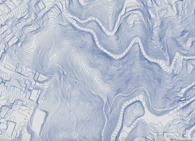
Topographic map of the area. Taken from Koordinates.com. Area to the front, facing Oriental Bay and the Bay area in general.
5m Topographic map

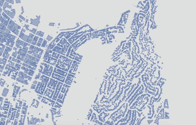
Versions and iterations of buildings in the area, and available park space (blank)
Mt Victoria has a active and keen historical society, established in 2007, and has used the extensive records to build up a catalogue of events and important aspects of the district. The community is strong and close, and protective of many of the sources of its pride, with many buildings designed by well known architects, and a long standing sense of pride in the area by its inhabitants.
Points of Interest taken from Site
- Multiple houses built by Developer George Baker ( 12 Albany Ave, 70 Brougham St, 20 Porritt Ave)
- Many public figures have history there, First woman to get a University Degree Kate Edger, Sea Captain Renner, Writer and Critic Charles Baeyertz, etc.
- Home to Greek Orthodox Church Hania St
- Home to Wellington East Girls School and Wellington College
- 105 Brougham St designed by Thomas Turnbull, striking red, orange, white and coloured wooden building, thought to once have been one of the grandest houses in the area. Turnbull also designed 91 Brougham.
- Home to many Art Deco inspired buildings and some of the best in Wellington
- 17 Brougham St – Owd Trafford, Art Deco apartment block of note. Also seen at 123 Brougham.
Link to article detailing the reason behind the famous act of tooting your car horn as you head through the Mt Victoria tunnel. Thought to be a tribute to a young woman murdered on the site via live burial, discovered while excavating for the new (current) tunnel.
Multiple Film Connections – Peter Jackson selected parts of Mt Victoria for use in the LOTR films, (Old quarry top of Ellice St, and Alexandra Rd) and a viral video, Full Moon Silhouettes, by Mark Gee, was shot at the Summit.
A memorial erected for Richard Byrd, American Polar explorer and Aviator stands below the lookout of Mt Victoria, and was designed to look as if a tent had been pitched. Officially named the New Zealand National Memorial to Rear Admiral Richard E. Byrd, it was unveiled on 11 March 1962, the fifth anniversary of Byrd’s death.
Te Aro Pa, Located Northeast from Te Aro Park almost beyond Taranaki Street, to Wakefield Street (the old shoreline), and east to Te Aro pa, Surveyed 1845. An archaeological dig at the historical site of Te Aro kainga in 1987 found no evidence of the kainga over a 2om x 2.4 m site extending to the harbour floor. Te Aro kainga was originally situated east of the Waimapihi Stream, which ran from Aro Valley to the sea past what is now the wide end of Te Aro Park. The name of the stream is of Ngäi Tara/Ngäti Mamoe origin, meaning “the stream (or bathing place) of Mapihi, a chieftainess of those iwi”. Most of the pä was purchased by the Provincial Government in the early 1870’s in order to extend Taranaki Street through it; central Government approved the purchases as a means of improving the inhabitants’ moral condition; at the same time, Parliament was considering a private bill to clear “Slums at Te Aro.” For two years in the late 1870’s, many of the remaining Te Aro people seized possession of the Native Reserves in Newtown in an effort to stop a long-term lease of the whole planned by the Native Reserves Commissioner.
Associated with the taniwha Whataitai. Relates to the naming of Hataitai district. When the taniwha died its spirit took the form of a bird (keo), that flew to the top of the mountain and cried farewell before departing – hence tangi te keo, keo being the word for both a bird and a peak.
Earthquake Susceptibility
- Low-medium Earthquake Zone
- some areas susceptible to slope failure and risk of landslide – noticeable Charles Plimmer park
- Low – no risk of liquefaction
- Low – moderate shaking felt
Also – medium Tsunami risk for North facing zones
